NitroX
|
| (.700 member) |
| 05/11/15 10:02 PM |

|
|
|
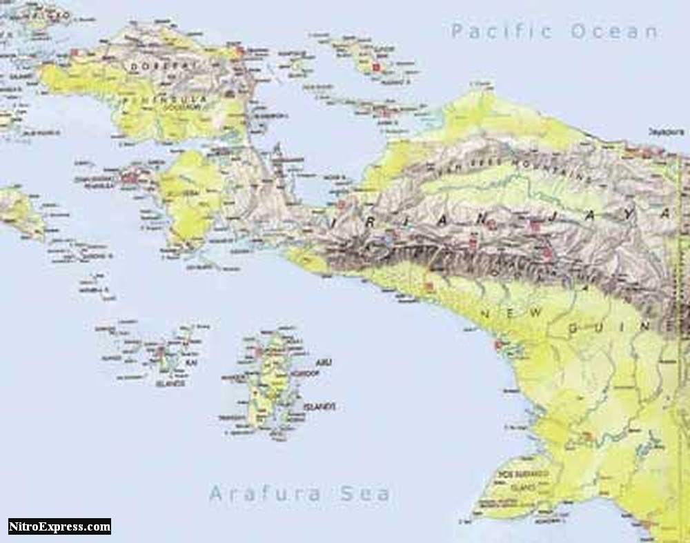
A map of West Irian, modern West Papua, now Indonesian territory. In Bahnemann's time it was Dutch territory.
Bahnemann describes the Digoel River as being a major river, similar in size to the Fly River in Eastern New Guinea.
I believe the name Digoel River has been changed since the territory became Indonesian territory and it has a new name. Maps on the internet, at least those I have found, are still sparse in information. Showing how this region still lives up to its reputation as a frontier territory. I still haven't asceh river is actually the Digoel River.
From the description of the sailing in the book, and also from examination of maps, it might be a river which flows out to the Arafura Sea East of the large island of Kolepom (?). Certainly that river is long and would have sizable flows as is described in the book.
But the Digoel River may actually be the smaller river (on the map smaller) that is located between the island of Kolepom (?) and the border to Papua New Guinea. An internet search of the word "Digoel" showed a camp for rebel west papua mpprisoners includes the word "Digoel" in its name. A camp in a fever mosquito hell hole ...
***
Worked it out.
I was right, it is the river to the North of this island, now known as Yos Sudarso Island. In the 1950's uninhabited by white man except for coastal Dutch military coast watching camps.
Quote:
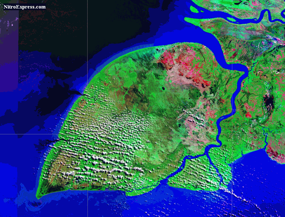
Pulau Yos Sudarso is an island in Papua province, Indonesia. It is separated only by narrow channels from the main island of New Guinea. It also known as Pulau Dolok, Pulau Dolak and Pulau Kimaam, has also been known as Kolepom Island, and in the Dutch colonial period was known as Frederik Hendrik Island.
https://en.wikipedia.org/wiki/Yos_Sudarso_Island
The Digoel River, now knows as the Digul River.
Quote:
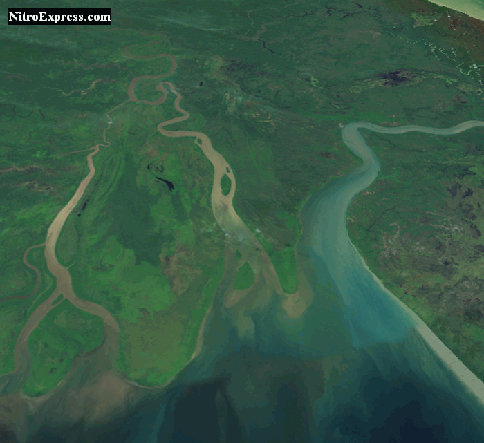
The Digul (Dutch: Digoel) is a major river in southern Papua province, Indonesia, on the island of New Guinea.
The swamplands upstream were known by the name "Boven-Digoel" (Above the Digul, in Dutch) and hosted a penal colony at Tanahmerah (Red Earth) in the early 20th century, when Indonesia was a colony of Holland. As a result of the abortive 1926 revolt by the Communist Party of Indonesia (PKI), the Dutch exiled 823 of the most troublesome revolutionaries here.[1]
Rising on the southern slopes of Maoke Mountains, the Digul flows first south and then west to empty into the Arafura Sea. For much of its length it travels across a low region of extensive swamps and creates a delta near Dolak (Frederik Hendrik) Island. The river has a length of 525 kilometres (326 mi) and is navigable as far as Tanahmerah.
https://en.wikipedia.org/wiki/Digul